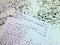
During the implementation of the project the situational-altitude maps were scanned, calibrated and adjusted to various coordinate systems. Also the longitudinal profiles of of railway lines and the delivery-acceptance acts were compiled. All togetherdata and mapscoveringover11 000 km of railway infrastructure was handedover. The aim of the project was to prepare and catalogue the documents for later use by the PKP PLK and also to improve the safety of the transport system.
Tuesday, 29 December 2015 09:51
THE COMPLETION OF THE GEODETIC DOCUMENTAION DIGITALIZATION FOR PKP PLK
The project of the geodetic documentation digitalizaton started in September 2015 has been successfully finalized. The data obtained by FONBUD whilst carring out the work will allow the carrier to improve the standard and the safety of the provided transport services.


